
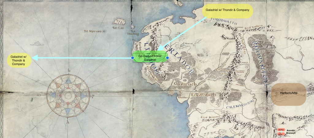
Exploring the Potential: Envisioning Middle-earth in Pakistan’s : For years, fans of J.R.R. Tolkien’s renowned works, “The Hobbit” and “The Lord of the Rings,” believed that Middle-earth drew its inspiration from Europe’s past. However, a groundbreaking finding by an Iranian Tolkienologist now suggests that present-day Pakistan’s topography might have influenced the fantasy realm. While Tolkien himself admitted “The Shire” was inspired by rural England, this new perspective challenges the Eurocentric view. Embracing this fresh interpretation allows us to expand our appreciation for Tolkien’s world, acknowledging the diverse cultural influences that might have shaped it.
Exploring the Potential: Middle-earth’s Geographic Clues
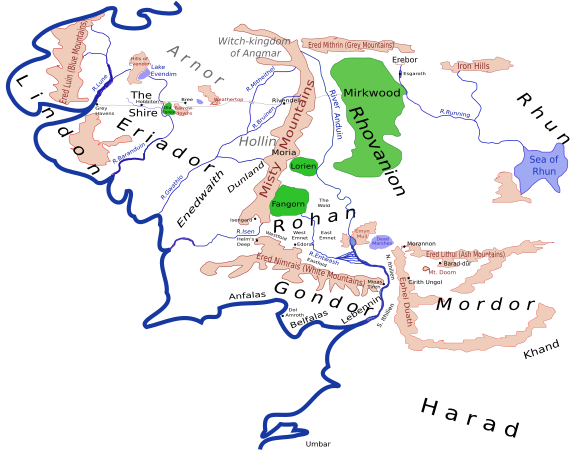
While Professor Peter Bird has connected Middle-earth’s geography to Europe, drawing from clues in Tolkien’s writings, a different perspective arises. Tolkien himself emphasized that the shape of his world was more dramatic than scientifically accurate, leaving room for alternative sources of inspiration. Recently, Mohammad Reza Kamali, in an article on Arda.ir, the Persian Tolkien Society’s website, presents intriguing findings. Through meticulous cartographic analysis, Kamali identifies real-world locations, some outside of Europe, that may have influenced Tolkien’s vision. Notably, he highlights the striking resemblance between the course of Pakistan’s Indus River and Middle-earth’s Great River, the Anduin.Exploring the Potential
Asian Influences: Rethinking Middle-earth’s Geographical Origins
Challenging the prevailing belief that Middle-earth drew inspiration solely from Europe, a groundbreaking discovery sheds light on the significance of diverse perspectives in unraveling Tolkien’s creative influences. During his meticulous cartographic study, Mohammad Reza Kamali stumbled upon a Google Map snapshot of Central Asia from around 2012, revealing a remarkable resemblance to key locations in Middle-earth. The circular arrangement of the Himalayas, Pamirs, and Takla Makan desert mirrored the haunting land of Mordor, home to Sauron and the forces of darkness. Translating Tolkien’s world, the Himalayas transformed into the foreboding Ephel Duath, the Mountains of Shadow, while the Tian Shan became the ominous Ered Lithui, known as the Ash Mountains. Kamali’s findings further suggest that Asia, particularly the Anduin, the Great River of Middle-earth, played a significant role in Tolkien’s cartographic imagination, as it symbolized the resting place of the One Ring for millennia.
The Tolkien’s Middle-earth
Mohammad Reza Kamali’s cartographic study uncovered intriguing connections between Tolkien’s Middle-earth and real-world locations beyond Europe. While examining a Google Map of Central Asia, Kamali identified resemblances between the Himalayas, Pamirs, and the Takla Makan desert with the dark realm of Mordor. He also noticed similarities between the Great River of Middle-earth, Anduin, and the Indus River in Pakistan. Kamali further proposed that Cair Andros, an island in the Anduin, might have been inspired by a similar-shaped island in the Indus River. Additionally, he discovered parallels between Tolfalas Island, near the mouth of the Anduin, and Kutch Island in the Gulf of Kutch. These findings provide intriguing evidence of diverse real-world inspirations for Tolkien’s imaginative world.
Unveiling the Hidden Treasures: Real-life Inspirations
Mohammad Reza Kamali, a curious researcher, embarked on a fascinating journey into J.R.R. Tolkien’s map of Middle-earth. To his astonishment, he uncovered remarkable parallels between the map and actual Asian locations. The distinctive contours of the Himalayas, Pamirs, and Takla Makan desert bore a striking resemblance to the forbidding realm of Udûn in Mordor. Kamali also detected intriguing similarities between the Anduin River and the Indus River, as well as between the fictional island of Cair Andros and a former river island in Pakistan, now submerged beneath the Tarbela Dam. These discoveries suggest that Tolkien intertwined real-world places into his map, possibly influenced by Britain’s comprehensive maps of India and Pakistan during the time of his writing. Kamali emphasizes the allure of these hidden connections, likening the map to an exhilarating treasure hunt crafted by a cunning professor who delighted in puzzles.